


Storm chasing and storm photography have been gaining popularity, coinciding with the release of Twisters (2024). My interest in storms came after the film Twister was released in 1996. I was in elementary school at the time, and I vividly remember the climactic scene and wondering if I could survive such an ordeal. From that moment, I couldn’t stop watching the skies.
When I was a teenager, we moved out of the city to a small farm. I watched cumulonimbus clouds billowing up on the horizon, and, from time to time, hid in the house while listening to ping-pong-sized hail hitting our roof. The real turning point was around 2009. I was visiting home after moving to Regina, and a big storm day was forecasted. Local meteorologists were talking about the possibility of big, long-track tornadoes, and everyone was on edge.
The sky got dark, and everything glowed an eerie green. You could hear the rumble of thunder and the roar of the storm on the doorstep. It was then that I saw something I will never forget: the Dominator – Reed Timmer’s armored chasing vehicle. That was the day I learned that people chase these monsters on purpose, and that Saskatchewan was a world-class storm destination.
The idea of chasing, running towards something so massive and unexplainable, instead of away, stuck with me. I even tried to do it myself in my little Hyundai Sonata a couple of years later. With my wife in the passenger seat and our newborn in the backseat, we headed out with a delayed radar app with a slow 3G connection out to Moose Jaw to go intercept an ongoing storm. We had no idea what visual cues to look for, no understanding of storm structure, and no clue which areas to avoid. Predictably, we got swallowed by the high-precipitation core, were nearly blown off the road, and hammered by hail multiple times.
It was a terrifying, harrowing experience that taught me an immediate lesson. Before we dive into forecasting, tracking, and capturing the raw drama of a prairie supercell, we need to have a serious, unfiltered discussion on how to do this safely.
Practicing Storm Photography Safely
Unlike many other forms of photography, the subject for severe weather is dynamic, fast-moving, and inherently dangerous. Across Tornado Alley (of which Saskatchewan is a part), severe storms claim lives each year. If you want to shoot storms, then safety must be your top priority.
The Danger of Delayed Data and Visual Blindspots
Relying strictly on standard mobile radar apps is one of the easiest ways for a beginner to get trapped. Radar data is inherently delayed by several minutes; by the time a heavy hail core or an area of rotation shows up on your phone screen, it may already be on top of your vehicle. Furthermore, high-precipitation (HP) storms can completely wrap a tornado in rain, making it invisible until it is too late. Chasing safely requires the ability to read real-time visual cloud structures and to be constantly mapping out a clear escape route on reliable roads.
Navigating the Prairie Grid Network
Saskatchewan’s extensive grid road network is exceptional for tracking, but severe weather introduces major hazards. Unpaved dirt and clay roads quickly transform into impassable mud when hit by a storm's core, capable of stranding even four-wheel-drive vehicles. I can’t count the number of times I’ve tracked a storm east and ran into Last Mountain Lake and had to plan a route around before getting impacted by the storm’s core. Combined with lightning hazards, flash flooding, and zero cellular reception in remote pockets, DIY storm chasing can quickly escalate from a photography trip into a survival situation.
The Ultimate Shortcut: Chasing with a Pro
The safest, most rewarding way to experience the raw drama of the Canadian Prairies is to head out with someone who reads weather models for a living. They’ve chased storms successfully for years, understand storm dynamics, and have driven the Saskatchewan road networks extensively. By joining an expert-led photography expedition, you skip the terrifying guesswork of forecasting, delayed radar and treacherous grid roads. You can leave the high-stakes navigation and real-time forecasting to an experienced guide, allowing you to focus entirely on setting up your tripod, dialing in your camera settings, and safely capturing the most spectacular weather on Earth.
Book a spot on a professional Living Sky Tours storm chase to safely track Saskatchewan’s most beautiful supercells alongside an experienced photographer.
How to Photograph Storms
You’ve done your research, maybe you’ve even taken the Spotter Network Training, and now have a solid understanding of storm dynamics. You’ve also practiced forecasting risk-free from the safety of your home, have a good radar app, and are comfortable driving on wet grid roads. You’re ready to get yourself into position for a photograph—where should you be?
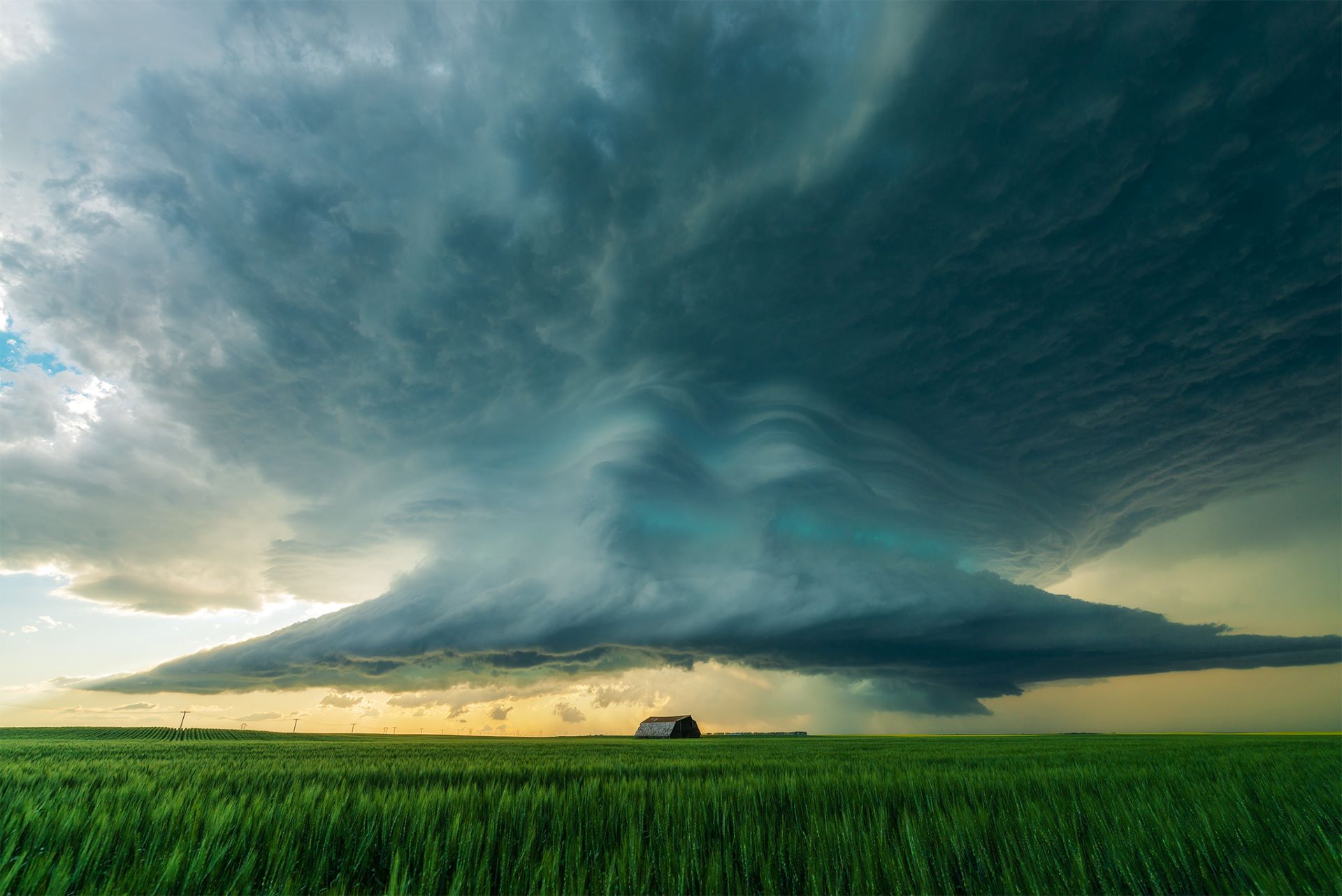
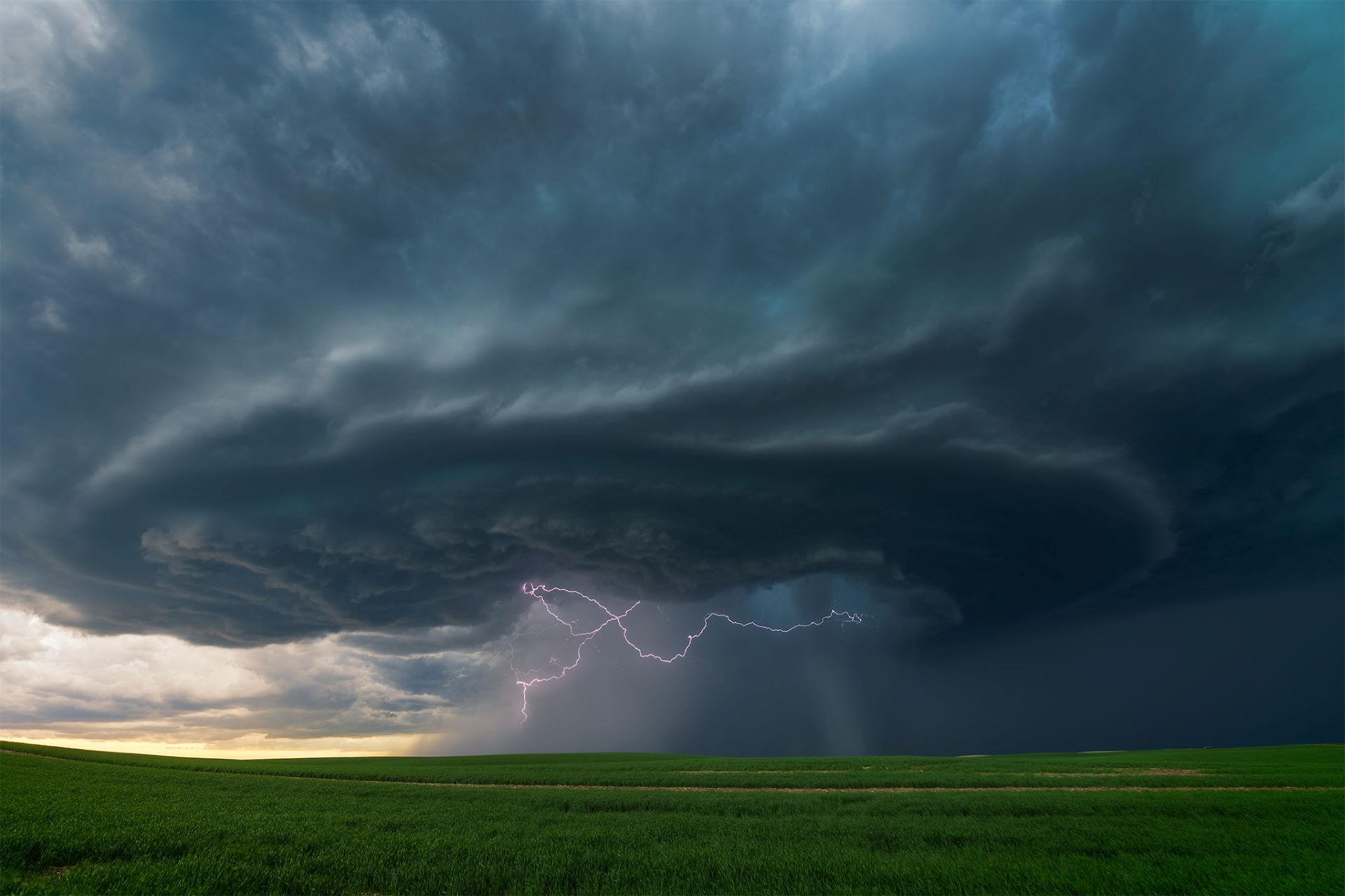
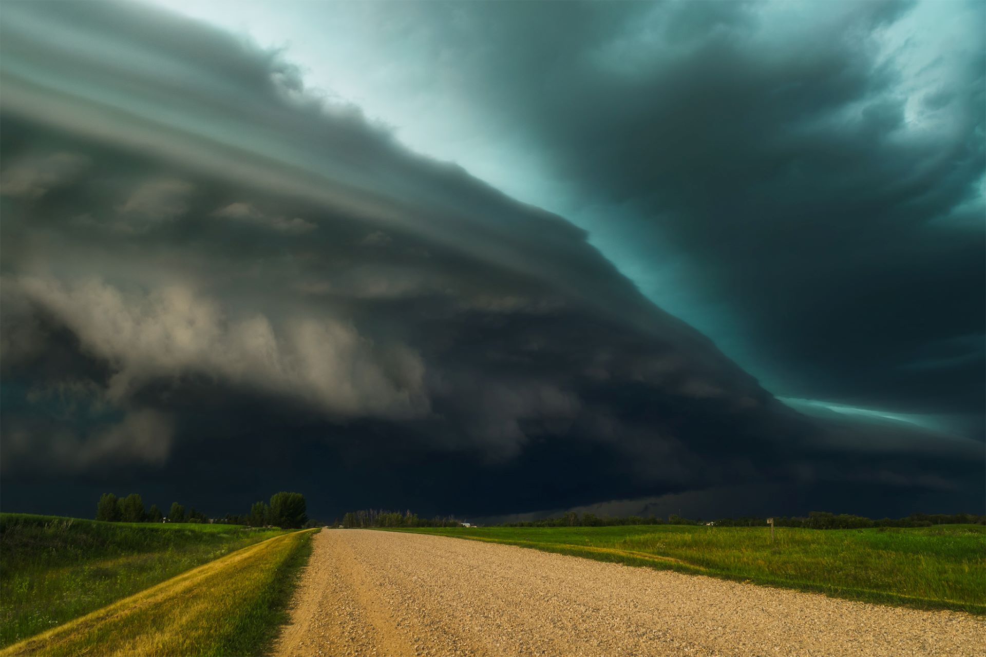
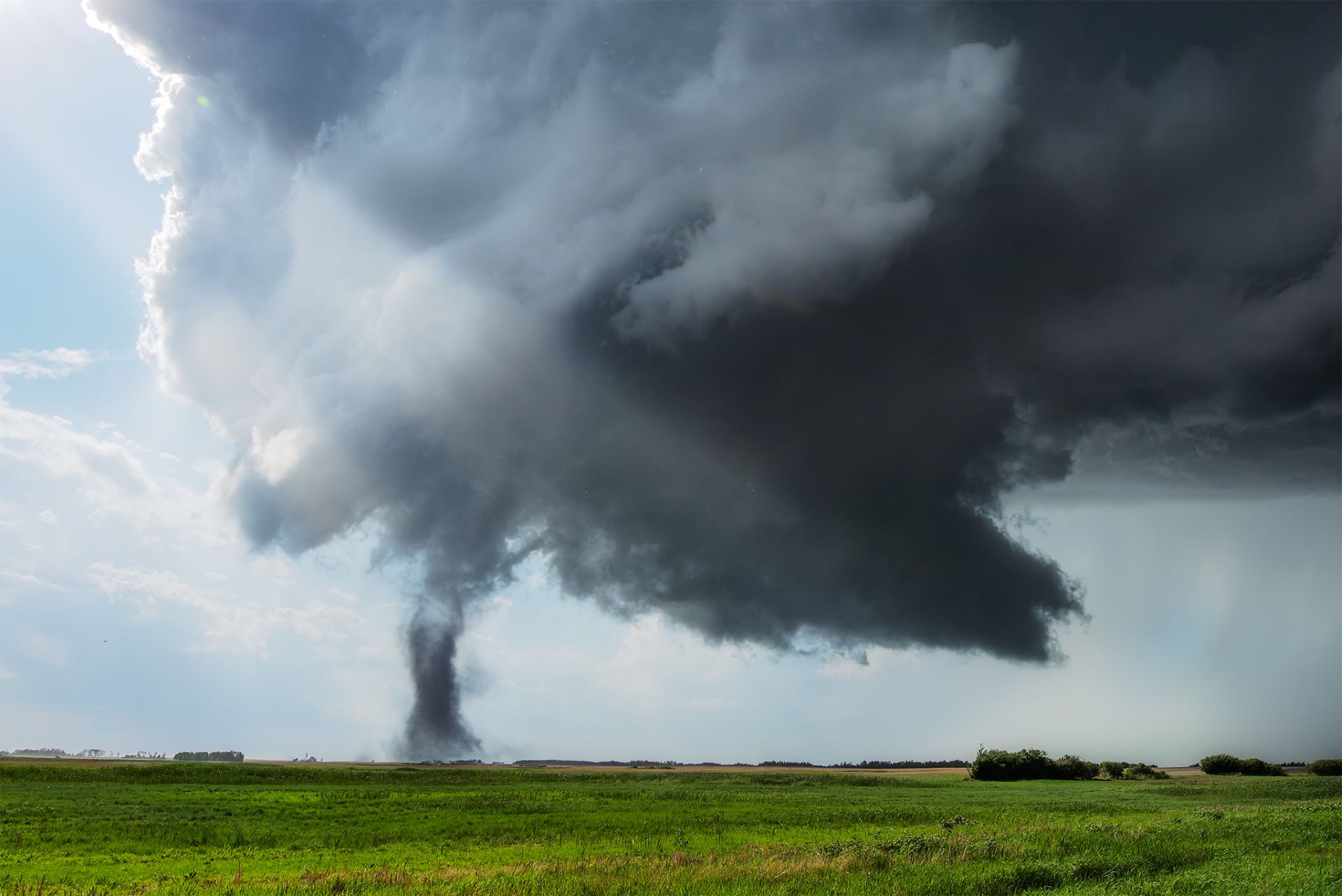
The Eye of the Storm: Capturing the Updraft
The holy grail for weather photographers is the updraft base. This is where the mesocyclone – a massive, rotating column of rising air that sculpts those breathtaking "flying saucer" or "stacked pancake" clouds – exists. But make no mistake: while this is the most beautiful part of the storm, it is also the most dangerous. This is exactly where tornadoes are born.
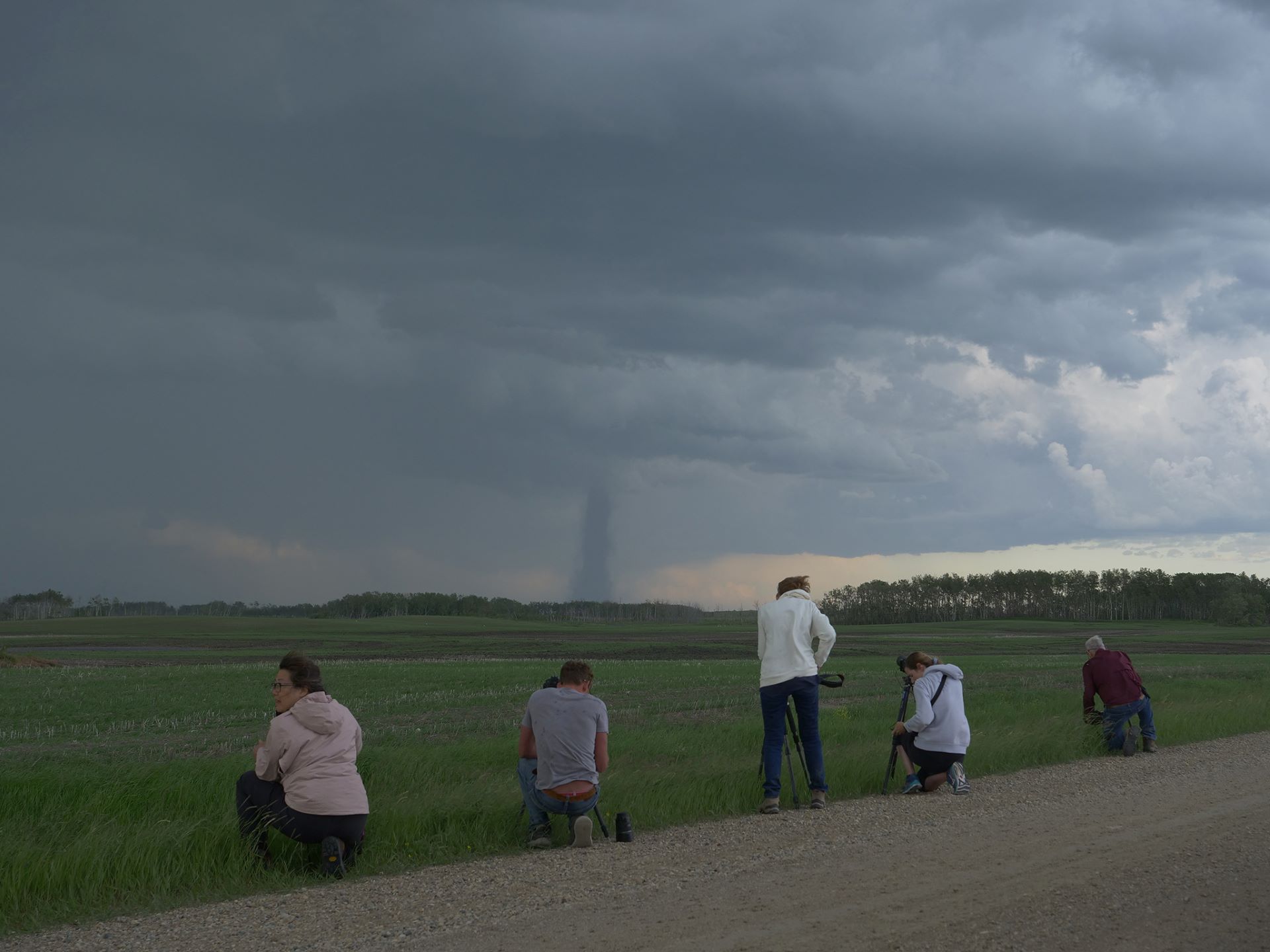
If you are a beginner, I highly recommend giving yourself a safety buffer of several kilometers between your camera and the front edge of the storm. This keeps you out of immediate danger while giving you the best wide-angle view of the structure. Generally, staying east or southeast of the storm's path keeps you safe, but these systems are incredibly dynamic and unpredictable. I have tracked powerful "right-movers" that suddenly took a sharp turn, abandoning their expected path to track directly south toward my position. Some of them become “outflow dominant” and gain incredible speed (storm motion of 60-80 km/h).
Your head must be on a swivel. You are dealing with a violent system that can change in an instant. If you get caught without a solid escape route (heavy grid or asphalt roads), heavy rain can turn clay/dirt roads into impassable mud traps within seconds. The learning curve here is steep, and the risks to your safety and your vehicle are real.
Knowing When to Hit the Road
Before you pack your camera bag, you need to know how to read the daily potential. A great habit is to regularly check the official Environment Canada Thunderstorm Outlook. If you see an orange risk category on the map, know that the atmospheric ingredients are highly volatile and the risks for large hail and tornadoes are elevated. If you are a beginner, skip the high-risk, heavily advertised severe days altogether. Instead, practice your tracking, positioning, and radar reading on smaller, marginal thunderstorms. It’s the absolute best way to build your confidence and level up your skills safely.
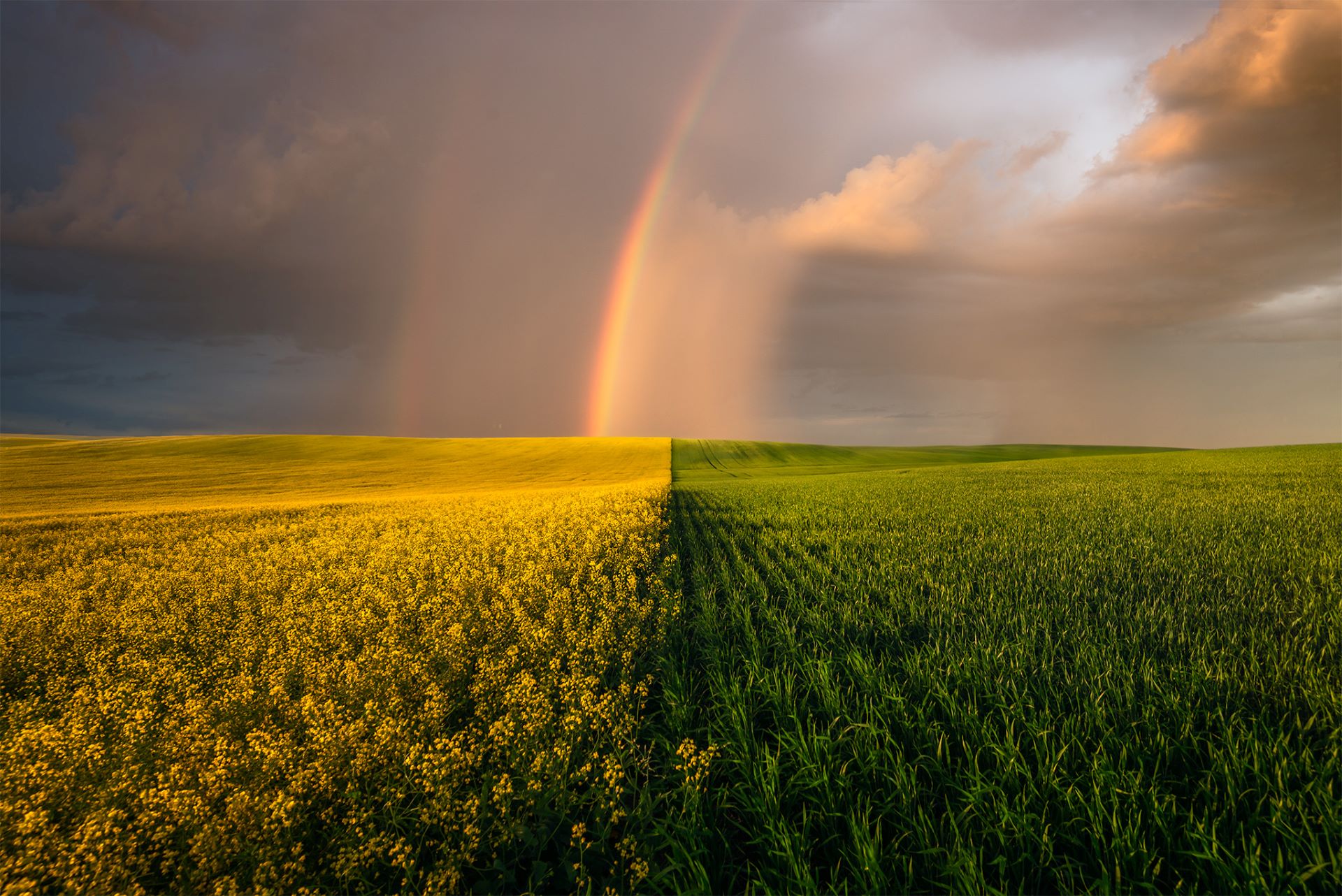
A Quiet, Safer Approach: The Backside of the Storm
If navigating the intense front of an active supercell feels too stressful, you can still capture spectacular severe weather imagery by targeting the backside of the system. Once the main storm front passes over your position, the immediate aftermath often yields the most beautiful photography conditions of the day. While the heavy rain and downdraft obscure the main mesocyclone structure, the backside rewards patient photographers with dramatic, clearing light, brilliant rainbows, and striking cloud-to-ground lightning. It is a fantastic, low-stress way to experience a storm chase without the adrenaline-fueled navigation.
Conclusion: Respecting the Prairies
Photographing a Saskatchewan supercell is an unforgettable experience, but nature always holds the upper hand. Whether you choose to shoot the dramatic updraft base from a safe distance or enjoy the brilliant lightning on the calmer backside of the system, success relies entirely on safety and preparation. Never underestimate how quickly a storm can change direction or turn a rural road into a trap. Keep your eyes on the horizon, respect the local weather alerts, and remember that no single image is worth risking your safety.